“We can’t choose where we come from but we can choose where we go from there…”
 |
| (On the highest mountain of Thailand) |
Day 12: 21 December 2015 (Monday)
Route: Doi Inthanon – Tak
Distance: 281 km
Route: Doi Inthanon – Tak
Distance: 281 km
Doi Inthanon, also known as the roof of Siam, is the highest mountain of Thailand at an altitude of 2,565 meters above sea level. The summit of Doi Inthanon is a popular tourist destination for both foreigners and locals. There is a Royal Thai Air Force weather radar station at the summit and the National Observatory is also nearby. On the main road to the submit stands two adjacent chedi.
After visiting the summit, we started riding downhill towards Tak. The weather gradually change from cool mountain weather to hot and humid. We reached Tak in the afternoon and went to Masjid Darassalam to perform our prayers and later had a late lunch at a nearby Muslim stall.
We checked in The Palm Resort and rested for a while. We had dinner at one Muslim restaurant situated at the main road.
 |
| (Thorough checks before we began riding) |
 |
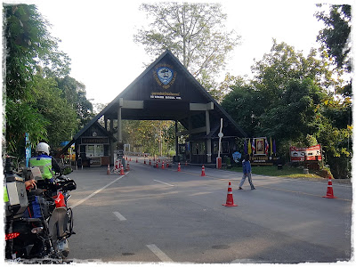
| (Arriving at the first check point to the summit) |
 |
| (A very good road leading to the top) |
 |
| (Entry ticket check at the second check point) |
 |
| (Riding the cool mountain road) |
 |
| (Arriving at the summit) |
 |
| (Time for a selfie) |
 |
| (A photo with the local visitors) |
 |
| (A short hike to the summit) |
 |
| (Yeah... I am at the highest spot in Thailand) |
 |
| (A walk in the wood) |
 |
| (Taking a short rest half way) |
 |
| (A nice picture of the forest) |
 |
| (Stopping at a view point on the way downhill) |
 |
| (The two chedi on the mountain) |
 |
| (Riding carefully downhill) |
 |
| (Riding the Chiang Mai loop road) |
 |
| (Crossing rivers and passing through small towns) |
 |
| (Passed a funeral procession) |
 |
| (Riding at a safe distance) |
 |
| (The bike taking a rest too) |
 |
| (Arriving at the Mosque in Tak) |
 |
| (Parking our motorbikes for the night) |


No comments:
Post a Comment